
- Offers remote wilderness experience on trails less frequented than other nearby recreation areas.
- Access to world class trout fishing.
- 50 miles of hiking trails, some easily accessible from Independence Pass (north side).
- Hunting and horse use permitted, following appropriate regulations.
- Convenient campsites available at Lost Man Campground on the Pass road.
- Located witihin White River National Forest and Aspen Ranger District (970) 925-3445.
Overview
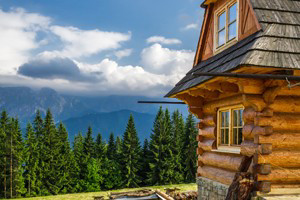
Located northeast of Aspen, CO, and to the north of Independence Pass, Hunter Frying Pan Wilderness offers solitude in the otherwise bustling greater-Aspen outdoor recreation area. While tourists flock to Maroon Bells, those seeking solitude would be wise to head to this often overlooked wilderness area.
Fishing
The designated land of Hunter Frying Pan Wilderness includes the headwaters of Hunter Creek and Frying Pan River, both considered gold medal streams for trout fishing, and bountiful Roaring Fork tributaries. Lost Man Lake and Lost Man Reservoir provide sources for cutthroat, brown and rainbow trout. For more information, contact Aspen Ranger District at (970) 925-3445.
Hiking
In this rugged wilderness of nearly 82,000 acres, with 50 miles of trails, one can certainly summon his or her inner John Muir.
- Lost Man Trail: This nearly 9 mile hike can be approached from two directions with a trailhead located across from Lost Man Campground on Highway 82, 14 miles east of Aspen, and another located on the north side of Highway 82 at the last switchback before the summit of Independence Pass. A shuttle should be arranged for those who do not desire to turn around, as the trail is not a complete loop. Distance from trailhead to trailhead is about 4 miles on the highway. The trail takes hikers past Lost Man Reservoir and Lost Man Lake with steep pitches making this a moderately strenous hike. As the trail does fork at various points, offering access to South Fork Pass and Midway Pass, it is important to consult a map to properly orient yourself before heading out on this hike.
- Williams Mountain (13, 382'): Take Lost Man Trail (location, see above) 5 miles to South Fork, then head northwest into the basin beneath the south face. Summit involves a scramble up a central couloir to the south ridge. With nearly 3000 feet elevation gained, a topo map, in addition to good judgment and proper gear and supplies, is certainly encouraged for this hike.
As applies to all hiking trails in White River National Forest, horse use is permitted on trails. Questions? Consult Aspen Ranger District at (970) 925-3445.
Hunting
The designated wilderness land provides habitat for elk and mule-deer, among other animals. Hunting is allowed within Hunter Frying Pan Wilderness with appropriate licensing. For more information, call the Glenwood Springs office of Colorado Department of Wildlife at (970) 947-2920 or use this helpful online resource for planning your hunt: http://wildlife.state.co.us/Hunting/PlanYourHunt/.
Camping
Lost Man Campground is located 14 miles east of Aspen on Highway 82 past Weller and Lincoln Gulch Campgrounds (both convenient as well to Hunter Frying Pan Wilderness). This campground offer sites for a maximum of five-days, with no more than eight people and two cars at each site. Site cannot be reserved. Offers potable water, firegrates and vault toilets with picnic tables at each designated site.