- World-class trout fishing.
- Whitewater stretches for rafting and kayaking.
- Camp sites along Independence Pass at the river's headwaters.
- For information call or visit White River National Forest District Offices in Aspen (970) 925-3445 and Carbondale (970) 963-0657.
Overview
With headwaters at 12,000 feet, Roaring Fork River, one of Colorado's steepest rivers, once known to Ute people as "Thunder River," earns its name with waters that cascade forcefully down thousands of feet. Similar to most of Colorado, settlers came to Roaring Fork River Valley with hopes of mining their way to riches. Remnants of these beginnings still remain. Towns in the river valley include (heading northwest) Aspen, Snowmass Village, Basalt, El Jebel and Carbondale. Made famous by vacationing celebrities and dignitaries in the post-war era, Aspen, with its abundant skiing, certainly reigns as the greatest local lure for recreationists and tourists. While the city offers much to do, its the natural surroundings of this river valley that steal the hearts of those who visit.
Location
Roaring Fork River runs the length of Highway 82 from Independence Pass summit grounds, at 12,000 ft, to the confluence of Colorado River at the town of Glenwood Springs, some 70 miles downstream. At Carbondale, Crystal River feeds the Roaring Fork, and Fryinpan River meets "the Fork" at Basalt. Most of the river's banks, with the exception of the headwaters on Independence Pass, are not designated National Forest land, like the vast majority of the mountainous territory, but, rather, falls under the jurisdiction of Beaureau of Land Management. For those interested in exploring the area, however, White River National Forest Ranger Districts in Aspen and Carbondale remain the best sources for information on recreation. Call (970) 925-3445 or 963-2266 or visit their website for information.
Seasons
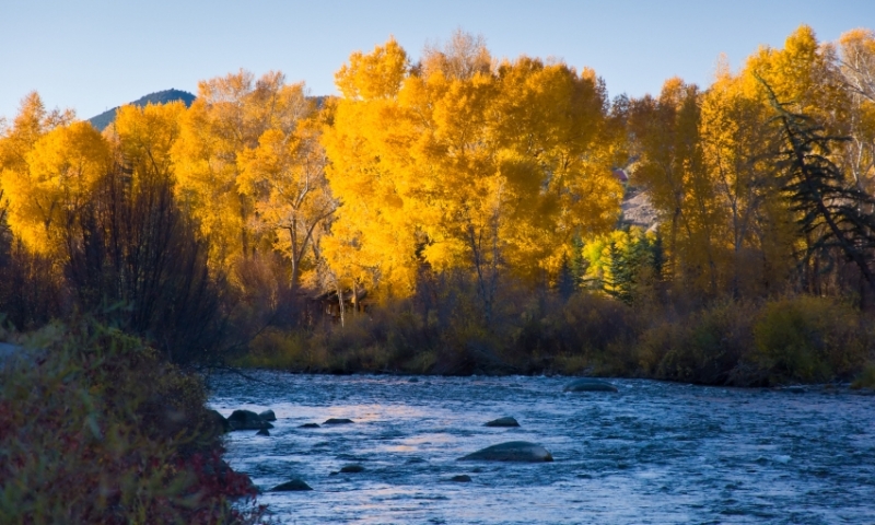
Throughout the cycle of a year's four seasons, Roaring Fork River Valley exists as if in constant celebration, with the clamour of color and sounds - the powerful waters and verdant, twinkling leaves; the silent, pearly snow and bellowing, lightning-flash thunderstorms - all mark a course for nature to retread, in infinite variation, year after year. Existing at such high altitude, regardless of the season, outdoor enthusiasts must prepare for extreme weather conditions, when setting out into the wilderness lands of the river valley.
Activities
Many local commercial enterprises create their work from the bounty of activities availed by the waters of the Roaring Fork.
Fishing
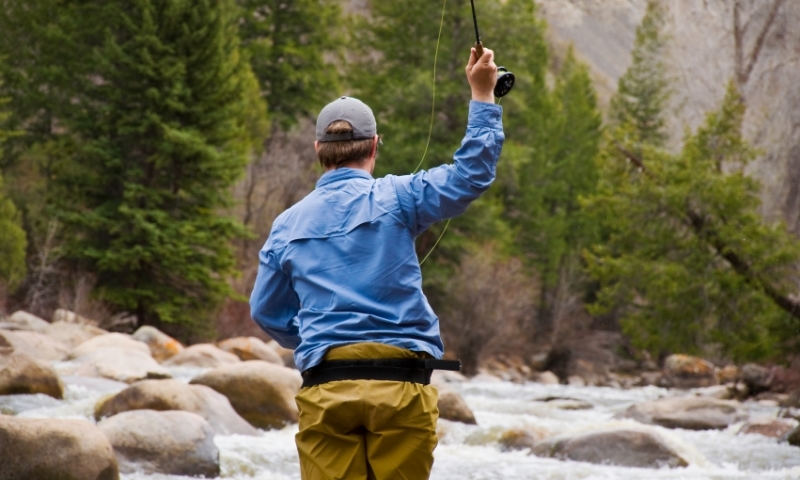
Fishermen rejoice! Roaring Fork River, and the surrounding tributaries, creeks and lakes, offer an abundance of trout - brown, rainbow, cutthroat and brook - for anglers of all skill-levels, whether wade- or float-fishing. For 28 miles, starting where the Fryingpan River (another haven to check out!) feeds in the the Fork, the river has earned the title of "Gold Medal Trout Water," the highest status attainable, and if you ask local anglers, the river lives up to this mark.
The Roaring Fork can be fished by foot or by drift boat. This year-round fishery will produce every month of the calendar year, but the edges get awful skinny and flows get heavy with spring runoff approaching 6,000 cfs. Given this fact, leave the river alone during runoff, but charge it from January to March and then again from July on.
The Roaring Fork is home to rainbows, browns and whitefish. Browns can get big with a few monsters here and there. The gold medal stretch offers browns in the two- to four-pound range.
From Glenwood Springs, follow Colorado 82 the total length of 58 miles to Lost Man Creek. There are more than 20 obvious access points as you make your way to Aspen. Some of the easier, more obvious access points include Woody Creek and Arbaney Gulch.
Boating
Perhaps the best way to enjoy the river is to float on it! There are plenty of commercial businesses that provide both scenic and whitewater raft trips down the Roaring Fork River. The upper section of the river proves the most popular as it is fast and narrow, providing many thrills along the way. Kayakers flock to these thunderous waters, too. There are frequent put-ins and take-out for those with their own watercrafts, as well as boat ramps in Basalt, Glenwood and Carbondale. As with all outdoor adventures, be prepared for present and changing conditions. Particularly, be prepared for frigid water temperatures.
Camping
For camping along the river, sites can be had at campgrounds on Independence Pass. With turn-offs on the Pass road, these campgrounds are well marked. Reservations can be made at Lincoln Gulch and Difficult Campgrounds (the latter has groups sites). Lost Man and Weller Campgrounds are first-come, first served. The sites offer the bare necessities with grated fires, picnic tables and vaulted toilets. Lost Man Campground, located the highest on the Pass, offers the most remote, wooded experience of the lot. Visit Camping Information or call (877) 444-6777 for information and reservations.